🔎 TL;DR
- The Progreso Malecón is the postcard SUP launch, but four lesser-known stretches of the Yucatán Gulf coast — Telchac Puerto, Yucalpetén harbour, Chuburná, and Sisal village — give you cleaner water, fewer cruise-day crowds, and richer wildlife.
- Yucalpetén is the calmest protected port on the whole coast: it sits behind a man-made breakwater that kills swell, so you can SUP even on Norte days.
- Telchac Puerto (45 km east of Progreso) has a quiet beach launch and a small ría that flows into a heron-and-pelican estuary — easily the most underrated route in the region.
- Sisal (60 km west) was declared a Pueblo Mágico in 2020 and sits at the edge of the CONANP-managed Ría Lagartos buffer; advanced paddlers only because of open Gulf exposure.
- None of these launches has cruise-tourism infrastructure. You pack water, you pack snacks, you launch from sand. That is the appeal.
- The Gulf has a real diurnal tidal range (around 0.5–0.9 m) per NOAA Ocean Service — unlike the near-flat Caribbean. Reading the tide chart is part of route planning here.
Why "beyond the Malecón" is the better Progreso SUP story
The Progreso Malecón is the easy answer. It is the long, palm-lined seawall stretching west from the cruise-ship pier toward Chicxulub, with paid parking, food carts, lifeguards on the swim end, and several beach concessions that will rent you a tabla de SUP by the hour. On a flat morning before the cruise ships disgorge their day-trippers, it is genuinely lovely. On a cruise day — and Progreso receives 100+ cruise calls a year per the Puerto de Progreso harbour authority — it becomes a parade of beach umbrellas, banana-boats and crowds. The Malecón is the SUP launch you start with. It is not the SUP launch you write home about.
This guide takes you past it. Four launches — east of Progreso (Telchac), inside the harbour complex (Yucalpetén), west along the coast (Chuburná village beach, distinct from the lagoon channels), and the far west outlier (Sisal) — give you the parts of the Yucatán Gulf that locals actually paddle on weekends. Each is ranked honestly on water condition, wildlife density, traffic and access difficulty. The first thing to know: the Gulf of Mexico shoreline along Yucatán is shallow and warm year-round, which means the issue is never water depth, it is always wind. Plan around wind windows — generally 6–10 am — and these routes deliver.
If you have not paddled the obvious routes yet, start with our four-route Progreso SUP guide, which covers the Malecón, Chelem lagoon, the Chicxulub jetty loop, and Chuburná mangroves. This article picks up where that one stops.
Telchac Puerto — the underrated estuary launch
Telchac Puerto is a fishing village 45 km east of Progreso on the Costera highway. The drive takes 55 minutes from the cruise pier, longer in summer weekends when Meridanos fill the road for beach days. The launch point is the public beach at the village centre, where you carry the board 80 m from a sand-and-gravel parking strip onto a wide shallow beach. The Gulf here is open but the bottom is sand for 200 m out, so the swell that does come in is broken and soft.
The real reason to drive to Telchac is what is behind the village: a small ría (estuarine channel) that flows toward the inland salt-pan zone. From the village beach you paddle 1.5 km east along the coast to the ría mouth, turn south into the channel, and immediately you are in a heron-and-pelican corridor with mangrove on both sides. We have seen roseate spoonbill, white ibis, snowy egret, brown pelican, and frigate-birds all on the same morning. Wintering migrants pile up here Nov–Mar. The ría is shallow (often under 1 m) and the bottom is soft mud — fall off the board and you stand up in muck, not water, which is fine but messy.
The route is roughly 6 km round-trip including the ría exploration, and it takes a relaxed paddler 2.5 hours. There is no rental on-site; bring your own board from Progreso or arrange a guided drop-off with the operator. The village has two seafood restaurants on the malecón for a post-paddle pescado tikinxic.
Quick read
- Level: Beginner+ (calm bottom, shallow water).
- Window: 6:00–10:00 am, wind window before the seabreeze.
- Wildlife: Excellent — best birding density of the four hidden launches.
- Hazards: Soft mud bottom in the ría; mosquitoes at dusk.
- Verdict: The single best Progreso SUP route you have never heard of.
Yucalpetén — the protected harbour for any-weather days
Yucalpetén is the deep-water fishing and naval harbour just west of Progreso, separated from the city by the long concrete pier of the international cruise terminal. The entrance to the harbour is a man-made channel between two breakwaters, and the inner basin — where the fleet of pangas and shrimp boats moor — is dead flat regardless of what the open Gulf is doing. This is the launch you save for Norte days.
From November to February, the Yucatán coast gets hit by Nortes — cold-front pulses that drop the temperature and push 25-knot north winds across the open Gulf for 24–72 hours at a stretch (the meteorology is documented in NOAA National Weather Service forecasts for the western Gulf basin). Open-coast SUP from the Malecón or Telchac is impossible during these. Yucalpetén still paddles. You launch from the inner side of the western breakwater (the local fishermen's slipway is the easiest access; ask permission, it is granted by default), and you have 1.5 km of straight-line flat water along the channel out to the harbour mouth and back. You will share the water with returning pangas and the occasional Mexican navy boat — stay on the south side of the channel and out of the central shipping lane.
The wildlife here is harbour wildlife: brown pelican diving inside the basin, laughing gull and magnificent frigatebird overhead, sometimes a curious great barracuda following under the board near the pilings. It is not a wildlife-first launch. It is a "the wind is howling and I still want to paddle" launch, and for that purpose it has no equal on the coast.
Quick read
- Level: Intermediate (boat traffic awareness needed).
- Window: Any day, any hour — protected basin.
- Wildlife: Limited but consistent.
- Hazards: Boat wake from returning pangas, fuel sheen near the docks.
- Verdict: The Norte-day insurance policy.
Chuburná village beach — the locals' weekend launch
Most articles about Chuburná send you to the mangrove channels behind the village — the narrow tunnel paddle we cover in our Chelem lagoon wildlife guide. That route is the headline. The lesser-known route is the open Gulf beach immediately in front of the village, 18 km west of Progreso, where Meridanos build summer beach houses and weekend traffic stays inside the town. The launch is from the public end of the beach at the western edge of the houses.
The Gulf here is the same shallow sand-bottom water you get at Telchac, but the beach is wider and the village restaurants are denser — Chuburná is genuinely lived-in, not a tourist village. The SUP route is a coastal 3 km out-and-back paralleling shore at 100 m offshore, with the option to cut north-west across an open stretch toward Chelem (5 km, intermediate). Visibility on the SUP deck is around 1–2 m on calm days, you will see schools of mojarra and sardine, occasional stingray on the sand bottom, and pelicans diving alongside.
The two practical advantages of Chuburná village beach over the Malecón: it never has cruise crowds, and it has the best post-paddle seafood on the coast. The two practical disadvantages: it has zero rental infrastructure (bring your board), and the parking on weekends is genuinely difficult after 10 am. Show up at 6:30 am, paddle until 9, eat ceviche, leave before the heat.
Quick read
- Level: Beginner (in close), Intermediate (full coastal crossing).
- Window: 6:00–9:00 am weekdays; 6:00–8:30 am weekends.
- Wildlife: Moderate — fish and birds, not estuary species.
- Hazards: Recreational swimmers after 10 am on weekends.
- Verdict: The locals' weekend SUP. Show up early.
Sisal — the advanced outlier with biosphere edges
Sisal is 60 km west of Progreso (about 70 minutes by car via Hunucmá), a small fishing village that became a Pueblo Mágico in 2020. It was the principal Yucatán port in the 19th century before Progreso superseded it, and the colonial fort and short malecón still stand. For SUP, Sisal matters for two reasons: it is the western-most paddleable Gulf launch before you commit to the long drive to Celestún, and it sits at the eastern edge of the buffer zone for the Petenes biosphere complex managed in part by CONANP.
The launch is from the public beach in front of the colonial fort, and the SUP route runs west along the open Gulf coast toward the entrance of the Bocas de Dzilam estuary system. The water depth out to 200 m offshore is under 2 m — classic Yucatán shelf — but the fetch is longer here than at Progreso because there is no offshore reef to break swell, and the wind builds faster in the afternoon. Sisal is an intermediate-plus launch only. The reward is wildlife: green sea turtles in the seagrass beds 400 m offshore (the species is on the IUCN Red List as Endangered, with the Yucatán nesting beaches monitored seasonally), magnificent frigatebird colonies on the offshore islets, and very rarely a West Indian manatee in the channel mouths — an Endangered species per the IUCN.
Sisal is not a launch you do on a whim. Drive there the day before, sleep in the village (two small guesthouses), launch at first light. Bring your own board, a fixed-blade paddle, a long leash, a PFD, and a phone in a dry case. There is no rental in the village. There is a Mexican navy detachment at the harbour — they will check on you if you are out long.
Want a guided run to one of these hidden launches? Book Progreso SUP →
The four hidden launches — ranked
| Launch | Distance from Progreso | Level | Wildlife | Traffic | Verdict |
|---|---|---|---|---|---|
| Telchac Puerto ría | 45 km east | Beginner+ | ★★★★★ birds | Very low | Best overall hidden route |
| Yucalpetén harbour | 4 km west | Intermediate | ★★ harbour | Boat wake | Norte-day insurance |
| Chuburná village beach | 18 km west | Beginner | ★★★ Gulf | Weekend swimmers | Locals' weekend SUP |
| Sisal village | 60 km west | Intermediate+ | ★★★★ turtles | Almost zero | Advanced outlier, biosphere edge |
How to pick your launch by skill and day
If you are a first-time SUP rider, you do not start with one of these. Start with the Progreso Malecón or the Chelem lagoon — both are covered in our 4 Progreso routes guide — and graduate up. Once you have 5–10 hours on the deck and you can self-rescue (kneel down, paddle in, climb back up) without falling, the hidden launches open up.
If the wind is forecast over 15 knots: paddle Yucalpetén only. Skip everything else.
If the wind is 8–15 knots and you have a morning window: Chuburná village beach for the in-close paddle, or Telchac for the ría (the ría is wind-protected by the mangrove walls).
If the wind is under 8 knots and you are confident: any of the four. Sisal is the once-in-a-trip choice.
Wind forecasts for the Yucatán Gulf coast are surprisingly reliable. The two we use are Windguru (look at the Progreso station model, refreshed twice daily) and the Windy ECMWF model. Cross-check both — if one shows a wind window and the other does not, default to the more cautious forecast. The Yucatán seabreeze is mechanical: it picks up around 10:30 am and runs to sunset, with peak around 2 pm. Plan to be off the water by 11 am unless you are paddling Yucalpetén or a protected ría.
Gear, logistics, and getting to the launches
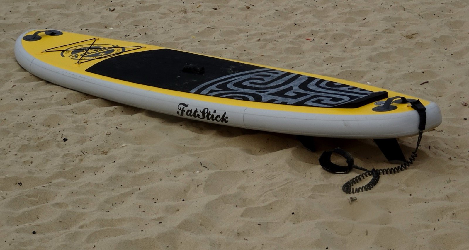
None of these four launches has a beach rental concession. For all of them, you either bring your own board (if you live in Yucatán) or you arrange transport with the operator who will deliver gear to the launch and pick it up after. The typical rate for board delivery to Telchac or Chuburná is around 350–500 MXN per board on top of the rental fee, and to Sisal closer to 800–1,200 MXN because of the drive. This is the part of Progreso SUP that costs less than the equivalent service in Cancún but takes more planning.
Vehicle: any sedan works for Yucalpetén, Chuburná and Telchac. For Sisal the last 200 m of road into the malecón is rough but passable for any car. Boards travel on roof racks; soft straps and a foam pad are sufficient for the Yucatán highway speeds.
Personal gear: UPF 50 long-sleeve top, hat with chin-strap, reef-safe sunscreen on exposed skin, 2 L of water minimum, a phone in a waterproof pouch on a deck leash, an inflatable PFD or foam vest, and the board leash always on a calf or ankle. The American Canoe Association SUP safety briefings cover the personal-floatation rationale; in Mexico the Marina-style regulation is that PFDs must be on-board, but in practice you wear them on these open-Gulf routes because no one is watching.
One detail specific to the Yucatán Gulf: the water is shallow enough that upwelling does happen, and on certain days the surface temperature can be 5–6 °C cooler than the air temperature. Most days the water is 26–29 °C and you wear nothing. On Norte days in January it can drop to 21–22 °C briefly, and a rash guard is welcome. The trend is captured in NOAA Ocean Service SST data for the western Gulf of Mexico.
Honest verdict — your three-route Yucatán SUP weekend
If you have a weekend on the Yucatán coast and want to skip the Malecón crowd, our recommended sequence is: Saturday sunrise at Telchac for the ría and the bird show, lunch in the village, drive back, afternoon rest. Sunday sunrise at Chuburná village beach for an easier coastal paddle and the post-paddle ceviche. Save Sisal for a future trip when you have a full extra day to drive out, sleep in the village, and paddle at first light without rushing.
Yucalpetén goes in the back pocket as your wind-day plan. If a Norte rolls through and Telchac or Chuburná is unsafe, you have the harbour as fallback. That is what separates Progreso SUP from Cancún SUP — there is always a paddleable spot somewhere on this coast, you just have to know where to drive. For the Cancún comparison side, see our SUP vs kayak Cancún guide.
Frequently asked questions
Can I rent a board for these hidden launches?
Not on-site. The Telchac, Yucalpetén, Chuburná village beach and Sisal launches have no beach concessions. You either bring your own board or you arrange board delivery with a Progreso-based operator. Delivery typically runs 350–1,200 MXN extra depending on distance.
Which launch is safest for kids?
Telchac inside the ría — the channel is sheltered by mangrove walls, the bottom is soft mud under 1 m, and the wildlife keeps kids engaged. Chuburná village beach is also fine if you stay within 50 m of shore. Avoid Sisal and the open coast of Yucalpetén for kids under 10.
Is Sisal worth the drive from Progreso?
Once per trip, yes — if you are an experienced paddler. The wildlife (turtles in the seagrass, occasional manatees, frigatebird colonies) and the absence of any tourism infrastructure make it special. For a casual weekend, stick to Telchac and Chuburná.
How do these compare to Cancún SUP routes?
Different ocean, different vibe. Cancún is Caribbean — clearer water, reef structure, denser tourist infrastructure, and higher prices. Yucatán Gulf SUP is shallower, more wildlife-driven, cheaper, and quieter. We cover the comparison angle in our SUP vs kayak Cancún article from the equipment side.
What about Celestún SUP?
Celestún is its own separate destination — 90 minutes west of Progreso, a UNESCO biosphere with strict CONANP-licensed guide rules around the flamingo zones. We treat it as a separate trip in our Celestún SUP flamingo routes article.
Plan your hidden-route Progreso SUP weekend
Tell us your dates, your skill level and your appetite for a drive — we route you.