🔎 TL;DR
- The Cabo bay is rideable year-round, but the realistic windows divide cleanly: November–April = morning rides only (the El Norte afternoon wind shuts the bay down by 14:00); May–October = all-day calm except for hurricane risk in August–October.
- Best months for glass-flat water: May, June, and early July — water 26–28 °C, viz on photo stops 15–20 m, mornings AND afternoons calm.
- Hurricane / tropical storm season per NOAA NHC: officially 15 May–30 November on the Pacific basin; peak risk Aug–Oct. Even a distant Category 1 in the eastern Pacific kicks a swell up the cape that closes the bay for 24–48 h.
- Whale season mid-December to mid-April: humpbacks and grays migrate through. CONANP rules under NOM-131-SEMARNAT require a 60 m distance from any whale — waverunners must alter course immediately if a whale surfaces nearby.
- Water temperature ranges from 20–22 °C in January–February (a 1 mm wetsuit top is comfortable) to 28–30 °C in August–September (bathing suit only).
- Daily wind cycle matters more than the monthly average. From October to April, plan to be off the water by 13:00; from May to September, daylight is the only constraint.
Why Cabo conditions split so cleanly into two seasons
The southern tip of the Baja peninsula sits at the meeting point of three weather systems: the Pacific high-pressure ridge to the north-west, the Mexican monsoon trough to the east, and the equatorial Pacific to the south. The interaction creates a remarkably reliable pattern that breaks the year into two distinct rideable seasons.
From November through April, the dominant feature is the "El Norte" wind — a north / north-westerly afternoon breeze that flows down the Pacific side of Baja and accelerates around Land's End into the bay. NOAA Ocean Service wind climatology shows mean afternoon winds at the cape in this period running 15–25 knots, with 30+ knot days common in December and January. Mornings under 11:00 are usually calm because the land-sea temperature differential hasn't built up yet; once the differential exceeds about 6 °C, the gradient wind cranks. By 14:00 the bay has 1.5–2 m chop, and most operators stop sending waverunner tours.
From May through October, the El Norte regime breaks and the bay sees genuine all-day calm conditions, with afternoon thermals running mild (10–15 knots) compared to winter. This is also the period when water temperatures climb to bathtub levels. The trade-off is the hurricane season — the eastern Pacific is one of the world's most active basins, and Cabo sits inside the cone.
This dual-regime climate is what makes scheduling a Cabo trip more important than for the Caribbean. In Cancún the lagoon is rideable virtually every morning year-round (we cover the seasonality side in our Waverunner Cancún Nichupté guide). In Cabo, you have to think about what month you are coming and what time of day you can ride.
Monthly conditions table — what to expect on a Cabo waverunner trip
Data reconciled from NOAA ocean buoy climatology for the southern Gulf of California (buoy 46028 and coastal stations), Mexican CONAGUA SMN local weather records, and operational logs from Médano concession holders. Sea state ranges are typical afternoon values; mornings run roughly 0.5 m lower in all months.
| Month | Water °C | Air °C (high) | Wind PM (kn) | Sea state PM (m) | Risk | Best window |
|---|---|---|---|---|---|---|
| January | 20–22 | 26 | 18–28 | 1.2–2.0 | El Norte daily | 08:00–11:00 |
| February | 20–22 | 26 | 15–25 | 1.0–1.8 | El Norte, whale traffic | 08:00–11:30 |
| March | 21–23 | 27 | 12–22 | 0.8–1.5 | Spring break crowds | 08:00–12:00 |
| April | 22–24 | 28 | 10–18 | 0.6–1.2 | Last whales | 08:00–13:00 |
| May | 24–26 | 30 | 5–12 | 0.4–0.8 | Low | All day |
| June | 26–28 | 32 | 5–12 | 0.3–0.7 | Heat | All day (heat by midday) |
| July | 27–29 | 33 | 5–14 | 0.4–0.8 | Heat, occasional chubasco | 07:00–11:00, 16:00–18:30 |
| August | 28–30 | 34 | 5–18 | 0.4–1.0 | Hurricane peak | Daily forecast required |
| September | 28–30 | 33 | 5–18 | 0.4–1.0 | Hurricane peak | Daily forecast required |
| October | 27–29 | 31 | 8–18 | 0.5–1.2 | Late hurricane | All day if forecast clean |
| November | 24–26 | 29 | 12–22 | 0.7–1.4 | El Norte returns | 08:00–12:30 |
| December | 21–23 | 27 | 15–28 | 1.0–1.8 | El Norte, whales arrive | 08:00–11:30 |
Ready to time your ride for glass-flat water? Book Los Cabos waverunner →
November to April — the "morning only" regime
The first thing to understand about winter and spring in Cabo is that the climate sells itself as "perfect" because every brochure photo is taken before 11:00. The brochures are accurate — those mornings really are perfect. They are just incomplete.
A typical winter day in Cabo goes like this. At 07:00 the bay is glass-flat. By 09:00 the sun is high enough to warm the land, but the wind is still under 8 knots. By 11:00 the gradient between the cool Pacific water and the heated peninsula starts driving an onshore-then-north-westerly wind that accelerates around Land's End. By 13:00 you have 15 knots in the bay; by 15:00 you have 20–25 knots and 1.5 m chop; by 17:00 sometimes 30+ knots. Operators that run afternoon tours in winter are either chasing money or have inexperienced captains — the bay is technically rideable up to about 18 knots, but it is not comfortable, and the swell pushing back from Land's End makes the return leg a slog.
The practical rule for November–April: book the 09:00 or 10:00 launch. A 09:00 launch puts you back at Médano by 10:30, with a comfortable 2 hours of margin before the afternoon wind builds. A 10:00 launch puts you back by 11:30, still fine on most days. A 12:00 or later launch is a coin flip — some days it is fine, many days you ride into building chop that makes the photo stops awkward and the return leg unpleasant.
Whale season inside this window — December to April
The same months that have El Norte wind also have the humpback and gray whale migration. Humpbacks (Megaptera novaeangliae) move into Cabo waters from mid-December, peak in February, and start moving out in April. Grays (Eschrichtius robustus) pass further offshore on their way to the Pacific Baja lagoons. The cape is one of the prime humpback breeding zones in the eastern Pacific, and during peak season you can see whales from the beach.
This matters for waverunner riders because CONANP enforces NOM-131-SEMARNAT, the federal whale-watching norm. The rules apply to all recreational craft, not just permitted tour boats:
- Minimum 60 m distance from any whale.
- 240 m exclusion zone around a mother-calf pair.
- No parallel chasing; if a whale changes direction to approach you, you must hold position or move off.
- Engine to neutral when a whale surfaces within 100 m.
The fines for violations run from MXN 20,000 to 300,000 (UMA-indexed), with criminal liability for repeated offences. Operators brief riders on the rules; they are not negotiable.
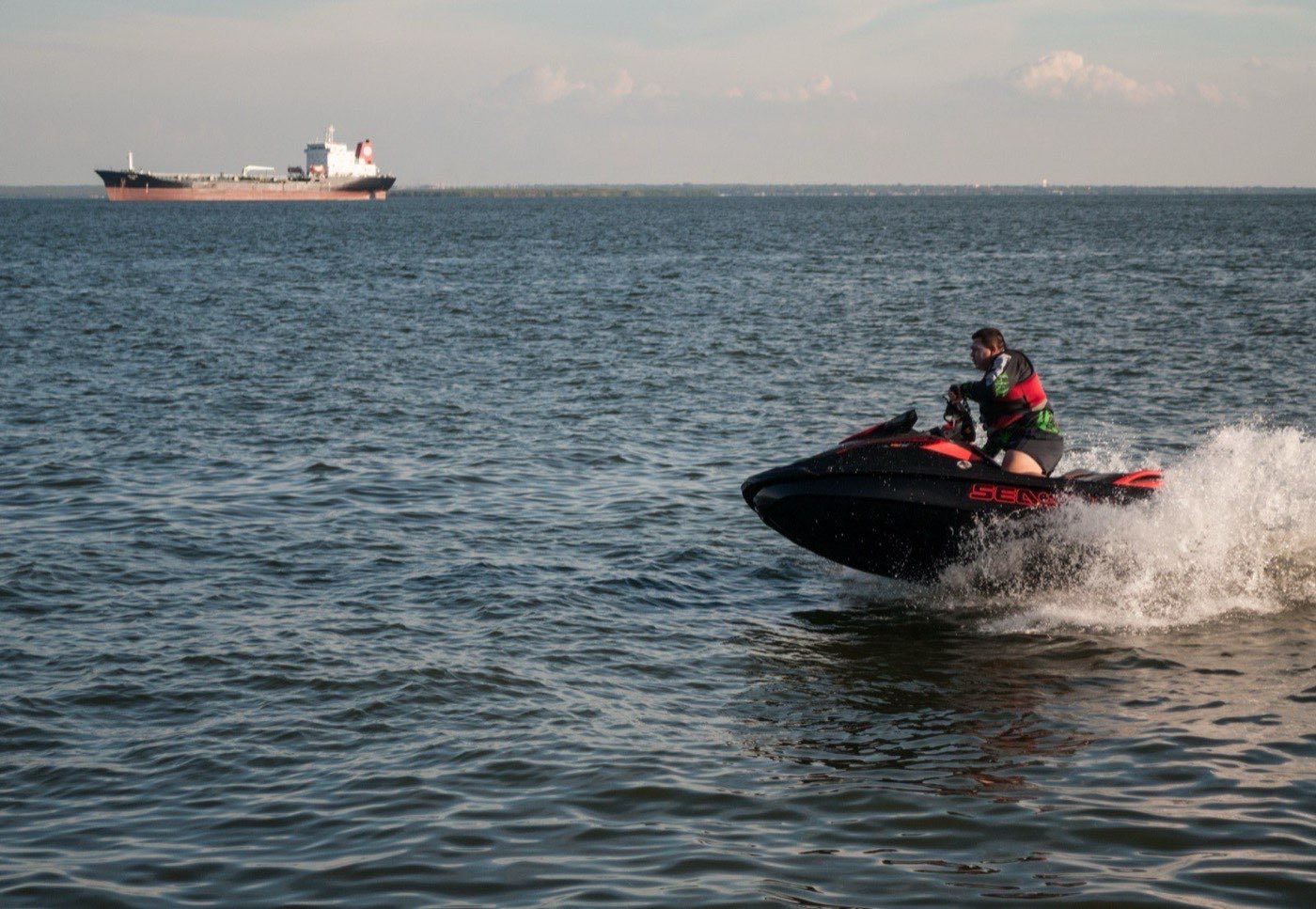
May to early July — the sweet spot
If you can choose your dates, ride in May, June, or the first half of July. The El Norte regime has broken, the summer monsoon hasn't started, hurricane season is just opening (and the peak is still months away), and the water has warmed to 25–28 °C. Sea state in the bay runs 0.3–0.7 m all day. Visibility on photo stops is 15–20 m. Air temperature peaks at 30–32 °C — hot but not punishing.
The trade-off for the sweet spot is that everyone knows it. Late May to early July is peak domestic Mexican vacation (US Memorial Day weekend, Mexican summer school break starting around 8 July). Concessions on Médano book full by 09:00 every morning. The 06:00–07:00 first-launch slot becomes valuable; some operators offer "sunrise" departures specifically because they sell out the day before.
Water temperature in this window is also when the bay has the most snorkel-able marine life. Pelican Rock is a working dive site year-round (we cover the dive product in our diving guide), but the surface snorkel experience peaks in June–July when water clarity is best and the schooling fish are densest.
August to October — hurricane risk season
The eastern Pacific hurricane season runs 15 May to 30 November per NOAA NHC, with peak activity from late August through early October. Cabo sits inside the historical track corridor; an average season produces 15 named storms, 8 hurricanes, and 4 major hurricanes in the basin, and 1–2 of those typically pass within 200 nautical miles of the cape.
The waverunner business in this window operates on a 48-hour forecast horizon. The local operators check NHC and Mexican SMN CONAGUA forecasts daily. A tropical storm or hurricane within 300 nm to the south or south-west pushes a swell up the cape that closes the bay 24–48 hours before the storm even comes close. The swell can persist 48 hours after the storm passes; total bay closure for a near-miss storm runs 4–5 days.
Cabo gets a direct hit (Category 1+ landfall within 50 nm) roughly once every 5–7 years on average. The last major was Hurricane Lidia in October 2023 (Category 4), and the last direct landfall before that was Hurricane Odile in September 2014 (Category 3). Outside of direct hits, the more common scenario is a tropical storm passing 100–200 nm offshore — bay closure, three days of fierce surf, then back to normal.
Practical advice if you are booking Cabo in August–October:
- Book refundable rates. Both the hotel and the waverunner operator should refund on documented tropical storm impact.
- Avoid the last week of August through the third week of September if you can. Statistical peak.
- Have a Plan B for the trip: yacht charters on calm days still run, but expect cancellations.
- Trust the operator's call. If they cancel the morning of, they have seen a swell on the forecast that you haven't.
Visibility, water clarity, and what photos actually look like by month
Photo quality on a Cabo waverunner ride is driven by three things: water colour, air clarity, and lighting angle. All three vary by month.
Water colour in the bay runs deep blue year-round because of the Cabo Submarine Canyon's depth — there is no shallow reef silting things up. Visibility on photo stops at Pelican Rock and Lover's Beach varies from 20+ m in May–July to 10–15 m in winter when the El Norte chop stirs the surface. Underwater clarity (for any drop-cam shots) follows the same pattern.
Air clarity is the variable most travellers overlook. From November to May, the air is dry and clean — distant horizons read crisp, and the arch silhouette is sharp against the sky. From late July through October, the monsoon trough pulls humidity north, and air clarity drops; you can still see the arch but the contrast is softer. This affects what your phone or DSLR can pull from a backlit sunset shot — drier air gives you more punchy oranges and reds.
Lighting angle at the cape changes meaningfully with season because Baja sits at 22.9° N. Winter sun maxes at 44° altitude in December; summer sun reaches near-zenith in June. For the iconic "arch silhouette at sunset" shot you want the sun setting roughly behind the arch from your photographer's viewpoint at Lover's Beach. The sun's azimuth at sunset varies from about 245° (south-west) in December to 295° (north-west) in June — so the exact angle you stand to align the arch with the sun moves dramatically across the year.
What other water sports look like across the same calendar
If the waverunner conditions don't align with your trip dates, the same Médano launch area runs other products that have different seasonality:
- Snorkel and dive at Pelican Rock: better in May–November when underwater viz peaks. Winter El Norte chop hurts surface snorkel comfort.
- Yacht charters: rideable year-round; the larger hull handles the El Norte chop that closes the bay to waverunners. See Los Cabos yacht charters.
- Whale watching: December to April only. Specialist tour, not a waverunner product.
- Pacific surfing (Todos Santos / Pescadero, 1 h drive): runs December to April when the same El Norte wind that closes the Cabo bay produces clean Pacific waves.
The honest planning move is to align your trip to the activity, not the activity to the trip. Cabo in December is a whale-watching destination first, a yacht-charter destination second, and a "morning-only waverunner" destination third. Cabo in June is a waverunner destination first.
Daily timing — how the wind cycle actually behaves
Inside any given month, the wind follows a daily cycle driven by the temperature gradient between the cool sea and the heated land. The pattern repeats with remarkable consistency:
- 05:00–08:00: Wind under 5 knots, often glass-flat. Land hasn't heated yet. This is when sunrise photos are sharpest and the bay looks like a mirror.
- 08:00–10:00: Light onshore breeze starts; 5–10 knots in winter, 3–7 knots in summer. Still excellent ride conditions.
- 10:00–12:00: The gradient builds. In winter it accelerates around the cape and becomes north-westerly; in summer it stays mild and onshore. This is the last clean window in winter.
- 12:00–15:00: Peak winter wind. The El Norte regime cranks to 20–25 knots. In summer this is the heat-of-day window; the wind is still mild but the air temperature peaks.
- 15:00–18:00: Winter wind starts to ease as the land cools; summer thermals start to ease. Late-afternoon rides become rideable again in winter from about 17:00.
- 18:00–20:00: Sunset window. Wind drops dramatically as the land-sea temperature differential collapses. Beautiful conditions for the sunset ride, year-round.
The takeaway is that you have two clean windows per day in winter (early morning and sunset), and one long window in summer (almost all day, with a heat break midday). If you only have one ride in your trip and you are in Cabo from November to April, take the sunset slot — the light is more interesting and the wind is reliable.
Frequently asked questions
What is the absolute best month for a Cabo waverunner ride?
June. Water at 26–28 °C, all-day calm, mornings still get the early-light photo opportunity, and the worst hurricane risk is still 4–6 weeks away. May is the runner-up — similar conditions but slightly cooler water. Both months also avoid the spring break crowds (Mar–early Apr) and the summer school-holiday peak (mid-Jul to mid-Aug).
Should I avoid Cabo waverunning in winter entirely?
No — you just have to ride mornings. Book the 09:00 launch, accept that the afternoon is for hotel pool, and you will have an excellent ride on water that is calmer than most people expect. Bonus: winter is whale season, and you may see humpbacks during the photo stops at Land's End. The only month I would actually avoid is January because water temperature dips to 20 °C and air can feel cold on a wet ride at 30 knots.
How do I check the conditions the day before?
Three sources: the NOAA NHC page for tropical activity (May–Nov), CONAGUA SMN for regional wind and sea state, and Windy.com or Surfline for hour-by-hour wind forecast. Your operator checks all three before confirming the launch. If you book through us we forward the operator's call the night before.
What happens if my whole trip is during a tropical storm?
The honest answer: you have a wet rainy week with no water activities, and you should claim travel-insurance weather coverage. The bay closes when a storm passes within ~150 nm; the closure usually runs 2–4 days. If your trip is 5–7 days, you typically still get a few rideable days even with a storm impact. Trip-cancellation insurance for hurricane season Cabo trips is genuinely worth it; we recommend booking it.
Can I ride at night?
No. SEMAR capitanía de puerto rules close the bay to recreational craft at the end of nautical twilight (about 40 minutes after sunset). No legitimate operator offers night rides. The sunset ride pushes the rule as late as it can — return to dock before nautical twilight ends.
When is the right month for you?
Tell us your trip dates — we tell you the rideable windows and whether to add a yacht charter as a backup.