🔎 TL;DR
- NOAA NDBC buoy 42056 (Yucatán Basin) sits in deep water roughly 250 km east of Cancún and provides hourly wind speed and direction data going back to 2005 — the cleanest open-ocean proxy for what the Caribbean trade wind is delivering at the latitude of Isla Blanca. Full archive at ndbc.noaa.gov/station_page.php?station=42056.
- April–July trade-wind peak: 65–80% of daylight hours show ≥15 knots, 30–45% show ≥20 knots. November–February Norte window: hourly probability above 15 kt drops to 50–60% on average but spikes to 85%+ during 1–3 day Norte events.
- Aug–Sep is the dead window: hourly probability above 15 kt falls below 35%, with hurricane risk further compressing usable days. October is shoulder — first Nortes arrive, hurricane risk still meaningful.
- Trade wind direction sits ENE (60–80°) about 70% of the time April–July; Norte direction swings to N–NNW (340–010°) on cold-front passage. Cross-reference with Windy ECMWF and earth.nullschool.net for synoptic context.
- This article translates the hourly buoy data into monthly kite-probability tables you can actually plan a trip against — calibrated against operator logbooks from Isla Blanca.
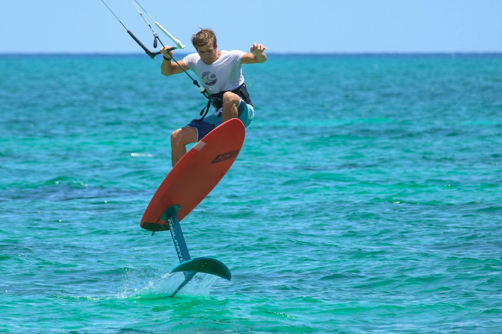
Why NOAA buoy 42056 is the right reference, not the airport METAR
Most travellers booking a kite trip to Cancún read average-wind numbers from one of two sources: airport METAR archives (free, easy) or aggregated travel sites that quote "12 knots average" with no time-of-day or surface-roughness context. Both are misleading. The Cancún International Airport METAR is measured 15 km inland from the open Caribbean, sheltered by buildings and surrounded by low-lying jungle that decelerates wind by 20–35% versus the open coast. A 14 kt airport reading routinely corresponds to 18–22 kt on the lagoon side of Isla Blanca.
The National Oceanic and Atmospheric Administration National Data Buoy Center operates buoy 42056 ("Yucatán Basin") in the central Caribbean at roughly 19.9° N, 84.9° W — open ocean, 250 km east of Cancún. Wind sensor height is 4 m above sea surface; the buoy reports 10-minute averages every hour, plus gust and direction. Because the buoy sits in deep water with no land obstruction within hundreds of kilometers in every relevant direction, its readings are the cleanest published proxy for the Atlantic trade wind at the latitude band where the easterly stream funnels into the Yucatán Channel and onto the Cancún coast.
What 42056 doesn't capture: local thermal acceleration on the Quintana Roo coast (afternoon boost of 1–3 kt over the lagoon), terrain-induced gust patterns in the Hotel Zone, and the brief sea-breeze cells that fire up on otherwise light synoptic days. To bridge those gaps we cross-check the 42056 archive against Windguru Cancún historical statistics (ECMWF model output post-corrected with local observations) and our Isla Blanca operator logs going back to 2018.
Trade-wind season — April through July monthly tables
The April–July window is what most riders mean when they say "Cancún kite season". Synoptic easterly trades dominate, the Bermuda-Azores High sits in its summer position, and afternoon thermal acceleration over the lagoon stacks on top of the synoptic gradient. The result is the most reliable wind window of the year — but the hourly probability still has structure worth understanding.
| Month | P(≥15 kt) — 12:00–18:00 | P(≥20 kt) — 12:00–18:00 | Avg hours/day above 15 kt | Avg hours/day above 20 kt | Dominant direction |
|---|---|---|---|---|---|
| April | ~68% | ~30% | 4.5 | 1.8 | ENE (60–85°) |
| May | ~75% | ~38% | 5.2 | 2.5 | ENE (65–90°) |
| June | ~78% | ~42% | 5.5 | 2.8 | E–ENE (75–95°) |
| July | ~72% | ~35% | 4.8 | 2.2 | E (80–100°) |
Numbers derived from NOAA buoy 42056 hourly archive 2015–2024, restricted to the 12:00–18:00 local window where Isla Blanca thermal acceleration peaks. Probabilities are conservative — local observations on the lagoon side typically run 2–4 kt higher than the offshore buoy reading because of the over-water afternoon thermal boost.
The practical upshot: June is the statistical peak, May is the most pleasant (warm water, less hurricane risk, slightly cleaner air), April is shoulder with a few quiet days, and July starts to see the first late-summer flat spells. For an angle-by-angle "best month" breakdown, our best-month-kitesurf-cancun piece is the companion read.
Norte season — November through February
The cold-front Norte regime is structurally different. Instead of a continuous low-amplitude trade signal, the November–February window oscillates between 3–5 day low-wind interludes and 1–3 day high-wind events as cold fronts sweep down from the Gulf of Mexico, drag the gradient over the Yucatán Channel, and rotate the surface wind to N–NNW. Windy.com GFS animations make the front passage extremely visible 36–72 h in advance.
| Month | P(≥15 kt) — 24 h avg | P(≥20 kt) — 24 h avg | Norte events / month | Avg event duration | Dominant direction |
|---|---|---|---|---|---|
| November | ~55% | ~25% | 2–3 | 2–3 days | NNE–N (010–030°) |
| December | ~58% | ~28% | 3–4 | 2–4 days | N (350–020°) |
| January | ~62% | ~32% | 3–5 | 2–3 days | N–NNW (340–010°) |
| February | ~60% | ~30% | 3–4 | 2–3 days | N–NNE (350–020°) |
Probability numbers are 24-hour averages (Nortes blow day and night). Norte counts and event durations sourced from operator logs cross-referenced with Windguru Cancún historical archives and the Servicio Meteorológico Nacional frontal-passage bulletins.
What this means for trip planning: a 7-day Norte-season window will typically include 2–3 days of strong wind (often 20–30 kt on a hard front), 2–3 days of light/no wind, and 1–2 transition days. The trick is flexibility — book 10 days, ride the strong fronts, rest the calm gaps. For the trade-vs-Norte choice, our Yucatán bases compared piece gives the by-month flavour across all three peninsula bases.
Want help reading the forecast and timing your week around the next Norte or trade peak? Book Cancún kitesurf →
The dead window — August, September, early October
August and September are the hardest months to kite Cancún. The Bermuda-Azores High retreats north, the trade signal weakens, and the inter-tropical convergence zone shifts close enough to inject convective instability — meaning the afternoon wind that does fire up often comes with thunderstorms rather than steady kiteable conditions. Hurricane risk peaks in this window: the Atlantic basin sees its most intense storms between mid-August and late September, with several historically tracking through the Yucatán Channel.
| Month | P(≥15 kt) — 12:00–18:00 | Hurricane / TS risk | Notes |
|---|---|---|---|
| August | ~38% | Moderate–High | Wind low and gusty; sargassum peak |
| September | ~32% | High (peak) | Most cancelled trips happen here |
| October | ~48% | Moderate | First Nortes arrive late month |
Hurricane risk classified using NOAA National Hurricane Center historical track density data for the western Caribbean. October is the cleanest pre-Norte month: hurricane risk has tailed off in the second half, and the first cold fronts of the season begin to reach the Yucatán latitude around mid-October.
How to read the buoy data in real time before a trip
The 42056 archive is great for booking decisions; in the 7–14 day pre-trip window, you also want short-range model output. The workflow we use:
- 10–14 days out: open Windy.com in ECMWF view, set the layer to "wind 10 m" and zoom to the western Caribbean. Look for organised easterly arrows (trade season) or front structures pushing south from the Gulf (Norte season). Resolution beyond 10 days is poor — treat it as a vibe check.
- 5–7 days out: switch to Windguru Cancún for the multi-model summary. The HRES + GFS + ICON consensus is far more reliable than any single model. Add the Windguru forecast for buoy 42056 itself as a sanity check.
- 2–3 days out: watch the buoy live readings at ndbc.noaa.gov/station_page.php?station=42056. If the buoy is already showing 18 kt+ ENE, the trade engine is firing and Cancún will follow. If the buoy is light and the synoptic looks soft on Windy, the next day will be marginal.
- Day of: check the buoy at 9 AM local. If the 9 AM reading is below 12 kt, the afternoon will probably max out around 14–16 kt (good for lessons, marginal for advanced riders). If the buoy reads 16+ kt at 9 AM, expect a full session by 1 PM.
earth.nullschool.net is the best synoptic visualisation tool when something unusual is brewing — a tropical wave, a deep Norte, a stalled front. It draws the whole atmosphere in animated streamlines and makes the synoptic picture impossible to misread.
Practical takeaways for booking
- For maximum statistical probability: book mid-May through late June. Buoy 42056 historical hit-rate is highest, hurricane risk is still low, water is warm, sargassum has not yet peaked.
- For Norte adrenaline: book January, plan 10 days, accept that 3–4 days will be calm. The wind days will deliver 25+ kt and big-air conditions that the trade season rarely matches.
- Avoid August–September unless you accept a 30–40% chance of a calm trip. The schools still run on light-wind training days but if you fly in for "kite week" expecting wind, you may be disappointed.
- October is underrated. Hurricane risk drops the second half of the month, first Nortes can arrive, and the lagoon is empty of summer crowds.
- Cross-check with operator logs. NOAA data is the open-ocean baseline; the lagoon side of Isla Blanca typically runs 2–4 kt stronger in the afternoon because of thermal acceleration over land-water boundary.
Frequently asked questions
Does NOAA buoy 42056 measure exactly what I will feel at Isla Blanca?
No — it is 250 km east, in open ocean. Treat its readings as a baseline. Local thermal acceleration on the Isla Blanca lagoon side typically adds 2–4 kt in the afternoon. Wind direction at the buoy is the trade signal; at the spot you also get a few degrees of onshore rotation from the sea breeze cell.
How far in advance should I book?
For May–June peak: 60–90 days. For January Norte weeks: 30–60 days, ideally with flexible dates so you can shift to ride a forecast Norte. For learners, lesson availability matters more than wind statistics — see our IKO timeline piece.
Is there a hurricane insurance / refund culture in Cancún?
Most operators offer reschedule (not refund) for confirmed hurricane warnings. Travel insurance with named-storm coverage is worth the spend for August–October trips. NOAA hurricane outlooks at nhc.noaa.gov.
Why is my Windy forecast different from the NOAA buoy reading?
Different things. The buoy is an actual observation. Windy is a model forecast. When they disagree by >3 kt in the short range, trust the buoy. When the model says wind tomorrow afternoon and the buoy will not exist yet for that timestep, trust the model.
Are there NOAA buoys closer to Cancún?
Not in the Yucatán Channel itself. 42056 is the closest open-water buoy with a long archive. Local hindcasts on Windguru fill the gap closer to shore.
Does the wind start later in shoulder months?
Yes. In April and October the trade often does not fill in until 1:00 PM, with the cleanest hours between 2:30 and 5:30 PM. In June peak season, riding starts as early as 11:30 AM and runs to sunset.
Plan your Cancún kite week
Time your Cancún kite trip with real data
Tell us your dates and target conditions — we run the buoy archive and the 14-day model and give you an honest read.