🔎 TL;DR
- Los Cabos has two opposite swell seasons: south-swell summer (May–Oct) lights up the Cortez side (Zippers, Monuments, Old Man's); north-swell winter (Nov–Mar) lights up the Pacific side (Cerritos, Pescadero).
- South Pacific groundswell from storms near New Zealand and the Roaring Forties travels 8,000+ km to hit the Cortez — long-period (14–18 s), clean, perfect, per Surfline regional analysis.
- North Pacific winter swells from Aleutian lows feed Cerritos with 1.5–2.5 m clean days from December through February.
- Hurricane swell (Aug–Oct) is the wild-card — Cat 1–3 storms 400–600 km offshore generate 2–3 m solid swell into the Cortez side per NHC climatology.
- April and November are the transition months — quietest swell, best for beginner trips because the contrast between coasts evens out.
- Water temp ranges from 20–22 °C in winter (light fullsuit or 3/2 helpful) to 27–29 °C in summer (boardshorts).
The two-season swell logic
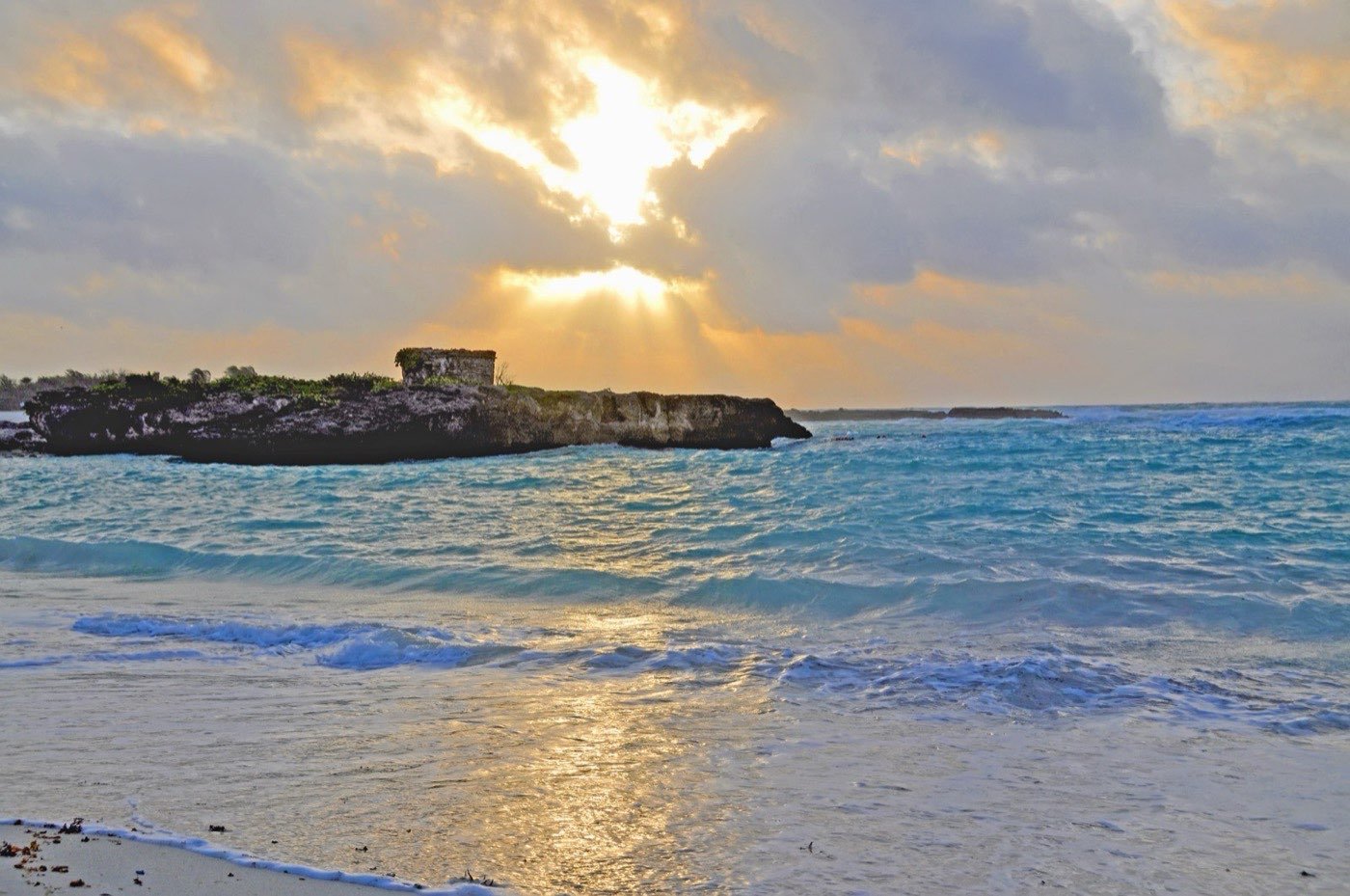
Most surf destinations have one productive season. Los Cabos has two, and they face opposite directions. Understanding this is the difference between a productive trip and a wasted week.
The Cortez side (Costa Azul corridor — Zippers, Monuments, Old Man's, Acapulquito, La Bocana, Nine Palms) faces south-southwest. It is dead flat with winter north swells but fires from May to October when south Pacific storm tracks send long-period groundswell wrapping around the cape. The Pacific side (Cerritos, Pescadero, Todos Santos) faces west-northwest. It picks up everything the Cortez side does plus the entire winter North Pacific storm window, so it is the more year-round of the two — but it peaks in winter when the Aleutian Low feeds it.
This is why the same trip can deliver "no waves anywhere" or "two completely different daily options" depending on which week of the year you book.
Month-by-month swell calendar
| Month | Cortez side (Zippers/Monuments) | Pacific side (Cerritos) | Water temp | Notes |
|---|---|---|---|---|
| January | Flat / tiny windswell | 1.5–2.5 m clean — peak season | 20–22 °C | Cerritos crowded, Cortez side empty |
| February | Flat / tiny | 1.5–2.5 m — still firing | 20–21 °C | Last big winter month |
| March | Flat to small bumps | 1–2 m — winding down | 21–22 °C | Transition starting |
| April | Small first south pulses | 1–1.5 m — quieter | 22–23 °C | Quietest month overall — best for beginners |
| May | 1–2 m — south swell kicks in | 1–1.5 m mixed | 23–24 °C | Zippers wakes up |
| June | 1.5–2.5 m solid south | 1–1.5 m | 24–26 °C | Cortez side getting good |
| July | 2–3 m peak season | 1–1.5 m + south wrap | 26–27 °C | Zippers + Monuments at peak |
| August | 2–3 m + hurricane wild-cards | 1.5–2.5 m hurricane wraps | 27–28 °C | Watch NHC tracks daily |
| September | 2–4 m hurricane peak | 2–3 m hurricane wraps | 27–29 °C | Biggest month — and most dangerous |
| October | 1.5–2.5 m tailing off | 2–2.5 m | 26–27 °C | Last hurricane pulses |
| November | Flat / occasional small south | 1.5–2 m first north swells | 24–25 °C | Transition — quietest month for big trips |
| December | Flat | 1.5–2.5 m winter peak starting | 22–23 °C | Cerritos firing |
South-swell season — May to October
This is the marquee surf window for Los Cabos and the reason advanced surfers fly in. The mechanism: deep low-pressure systems form in the South Pacific (between New Zealand, Tahiti, and the Roaring Forties latitudes around 40–55° S), generate massive seas, and send groundswell northward. Travelling 8,000–10,000 km, the swell arrives at the Mexican Pacific as long-period (14–18 second), clean, organised energy.
Because the Cortez side faces south-southwest, this swell wraps right into Zippers, Monuments and the entire Costa Azul corridor. Sets stack up perfectly. The Surfline regional forecast for Baja Pacific highlights this window every year.
- May: first pulses, 1–1.5 m. Crowds light. Good time for intermediates to get familiar.
- June–July: building into 1.5–2.5 m on the cleanest days. Daily morning sessions before east trades blow it out at 11 a.m.
- August–September: peak. Add hurricane swell layered on top of background south. Days can go from 1.5 m to 3+ m overnight.
- October: tailing off, last cleanups. Still very rideable, smaller crowds.
During this window, Cerritos still has some surf from south-swell wrap, but it is messier and shorter-period than the wraparound at Zippers. Most experienced surfers focus on the Cortez side from May through October.
Surf the south-swell window with us. Book Los Cabos surf →
North-swell season — November to March
While the Cortez side hibernates, the Pacific side wakes up. Aleutian Low pressure systems north of Hawaii spin off into the eastern North Pacific, generating storms that send swell straight at Baja California from the west-northwest. Windy and Surfline both show these clearly on the 7-day forecast.
Cerritos and the spots from Pescadero up to Todos Santos receive this energy head-on. The water gets cooler (21–22 °C in January), the air drier, the swells more consistent than summer. A typical winter week in January will have at least 3 days of 1.5+ m clean groundswell.
- November: first pulses arrive. Variable.
- December–February: peak. Multiple swells per week. Cerritos crowded with surf schools, longboarders, and visitors escaping cold North American winters.
- March: winding down but still productive. Less consistent.
The Cortez side is essentially flat throughout this window. If you fly in for a January surf trip and base in San José del Cabo, you are committing to the 50-minute drive to Cerritos every morning, or you base in Pescadero / Todos Santos directly.
Hurricane swell — the August to October wild card
Layered on top of background south swell, August through October brings the hurricane window. Eastern Pacific hurricanes (different from Atlantic ones — see our Cancún hurricane piece for the Atlantic side) form off southwest Mexico and track northwest toward Baja. According to NHC climatology, the eastern Pacific season runs May 15 – November 30 with peak activity August through September.
The geometry that produces ridable swell at Los Cabos: a Cat 1–3 hurricane passing 400–600 km offshore, southwest of the cape. That distance pushes long-period (15–20 s) swell into the Cortez side without bringing the storm itself onshore. Magic days — Zippers and Monuments at head-and-a-half, sometimes double overhead.
The risk: hurricanes are unpredictable. A storm forecast to pass offshore can curve toward the cape. Read NHC advisories every 6 hours during the window. Never paddle out within 200 km of an active hurricane — rip currents become deadly.
Wind, tide and the morning glass-off pattern
Regardless of swell, the daily wind pattern dictates session timing:
- Dawn to 10 a.m.: glassy. Light west or no wind. This is when 80% of clean Cortez-side surfing happens.
- 10 a.m. – 2 p.m.: east trades build to 15–20 knots. Onshore on the Cortez side, cross-shore at Cerritos. Conditions deteriorate fast.
- 2 p.m. – sunset: trades sustain. Surfable for kite/windsurf, blown out for surf.
Tide matters too: most Cortez-side reefs work best mid-tide. Low tide exposes urchin-covered rocks; high tide can drown out the wave. Bring a tide chart or check the Surfline reports daily.
Forecasting your swell — the 7-day discipline
Forecast reliability falls off a cliff past 7 days. Anything beyond that is climatology, not a forecast. Inside the 7-day window, the discipline that produces consistent surf-trip results:
- 7 days out: glance at the storm pattern. Is there a south Pacific storm at 40–55° S latitude generating 4+ m seas? That energy will arrive in Los Cabos in 5–7 days. Adjust expectations.
- 5 days out: look at the buoy data from offshore stations (Mexico's CONAGUA buoys plus US NOAA equatorial buoys). Confirm the swell is propagating as forecast.
- 3 days out: lock down your spot priority. South swell = Cortez side. WNW swell = Pacific side. Both = pick by tide window.
- 24 hours out: Surfline's hourly forecast becomes useful. Wind direction, tide phasing and exact swell size narrow down.
- Morning of: webcam check (Surfline has cams at Zippers and Cerritos). Confirm visual reality matches forecast.
Surfers who religiously read forecasts during these checkpoints get 30–50% more productive sessions than those who arrive and check on the day. The forecasts are not perfect — periodic surprises happen — but they catch 80% of the swell math.
When to plan your trip
- Pure beginner: April or November — quietest swell, gentlest learning conditions, lower crowds at Cerritos.
- Intermediate longboard: November to February for Cerritos winter peak. Consistent 1.5 m, longboard-friendly shoulders.
- Intermediate shortboard: May, June, late September, October — south swell that's not maxing out, working at 1.5–2 m.
- Advanced: July–September. Big south, hurricane wild-cards, Zippers and Monuments at their best.
- Photo trip: late August / early September. Hurricane swell + dramatic skies = best shots.
Pair the surf with diving, fishing or yacht days on quiet swell mornings — see all Los Cabos activities for the menu.
El Niño, La Niña and the inter-annual variance
The mean swell calendar above describes a typical year. Real years bend around that mean depending on Pacific oscillations. The two cycles most relevant to Los Cabos surf:
- El Niño (ENSO warm phase): warmer Pacific equatorial waters shift storm tracks. Los Cabos sees slightly warmer water year-round, more frequent south-swell pulses in spring (extended Apr–May activity) and often more hurricane activity in the eastern Pacific. The 2023 El Niño year delivered an exceptional August–September with Cat-3 Hilary tracking past the cape.
- La Niña (ENSO cool phase): cooler equatorial waters. North Pacific storm tracks tend to dive further south, sometimes feeding Cerritos with bigger winter swells than average. Hurricane activity in the east Pacific is usually below average but Atlantic hurricanes pick up — relevant if you're choosing between a Pacific-Mexico and a Caribbean-Mexico trip in the same year.
- Neutral years: classic swell calendar holds. Most reliable for planning 6+ months out.
NOAA and the Climate Prediction Center publish ENSO forecasts each season at noaa.gov. For trip planning more than 6 months ahead, glancing at the current ENSO state is worth 5 minutes — it can shift expected wave size by 20–30% relative to the mean.
Tide cycles and the small-window discipline
Beyond swell and wind, tide is the third variable that can make or break a session. Los Cabos has a mixed semi-diurnal tide pattern with two highs and two lows per day, of unequal heights. The range is moderate — about 1.0–1.5 m on spring tides, 0.5–0.8 m on neap tides — but for reef breaks like Zippers and Monuments, even half a metre of tide change is the difference between clean overhead barrels and dry urchin-covered rock.
General rules for Los Cabos:
- Cerritos (sand): works at any tide. Low tide produces steeper waves and exposes the north-end rocks. High tide produces fatter, slower waves. Mid is usually optimal.
- Zippers (cobblestone reef): best from mid-rising to mid-falling. Low tide makes the inside dangerously shallow; high tide drowns the wave and makes it shapeless.
- Monuments (boulder reef): similar to Zippers but slightly more tide-tolerant on the high end. Avoid low tide entirely — the wash-in onto exposed boulders is genuinely dangerous.
- Old Man's: tide-tolerant but cleanest at mid.
- La Bocana (rivermouth): dependent on sandbar shape that itself depends on recent storms. Low to mid tide usually fires.
The discipline this enforces: your daily session window is the intersection of glassy morning + workable tide. On a bad alignment day, you might have a 90-minute window only. On a good alignment day, you might have 4 hours. Pull up tide charts and the Surfline tide overlay nightly. Plan tomorrow's session before bed, not over breakfast.
Combining swell-day surf with non-swell-day activities
Even in peak season, you will not get clean surfable conditions every day of a 7-day trip. The east trade winds blow most afternoons; periodic onshore days happen. Smart Los Cabos planning is surf in the morning, do something else in the afternoon:
- Cabo Pulmo dive day on a flat morning — see our Pelican Rock guide.
- Sport-fishing morning for marlin or dorado off Cabo San Lucas, returning by noon.
- Kitesurf at Los Barriles in the afternoon when east trades fill in — they kill the surf but make the kite.
- Yacht half-day to El Arco — sunset cruise with the surf gear stowed.
- Whale-watch in Dec–Mar on the Pacific side.
This is one of the underrated arguments for Los Cabos as a surf destination over single-purpose surf towns: the alternative activities are world-class. A "wasted" non-surf day in Los Cabos is still a great day. The same cannot be said of most surf-only destinations.
Book on the right week. Plan Los Cabos surf →
Frequently asked questions
What is the best single month to surf Los Cabos?
September if you are advanced — peak south swell plus hurricane wild-cards at Zippers and Monuments. January if you are intermediate longboard — Cerritos clean and consistent.
Can I surf Los Cabos in April?
Yes but it is the quietest month. Small Cerritos days (1 m), first south pulses just starting on the Cortez side. Great for first-time travellers; less so for advanced surfers chasing size.
Do I need a wetsuit?
Summer: boardshorts. Winter (Dec–Feb): water is 20–22 °C, a spring suit or 3/2 fullsuit helps if you are surfing dawn patrol or sensitive to cold.
How do I track south swell remotely?
Surfline forecasts give 16-day outlooks. Look at the South Pacific MSLP charts on Windy.com for storms south of Tahiti. A storm at 35–50° S latitude generating 4+ m seas usually arrives in Los Cabos 5–7 days later.
Does El Niño / La Niña affect Los Cabos surf?
Mildly. El Niño years have slightly more south swell and warmer water. La Niña years can deliver bigger winter swells from the North Pacific. Neither cancels a season; both shift averages.
Pick the right week
Tell us your level and travel window — we tell you what the swell will probably do.