🔎 TL;DR
- Cancún surf is directional: which way the wind and swell point matters more than how big the storm is. The Caribbean coast only "catches" three directions — ENE, E and a rare SE.
- Nov–Mar = ENE swell season (Nortes / cold fronts). Most reliable surf window. 30–45% of days have something rideable.
- Apr–Jun = light E trade wind-swell. Mostly flat. The "off-season" for surfers.
- Jul = the deadest month. Glass and calms. Plan around it.
- Aug–Oct = hurricane swell windows. Can produce the biggest, cleanest waves of the year — also the most dangerous. Track via NHC and NOAA.
- Verify with Surfline, Windy and Magicseaweed models 48 h out.
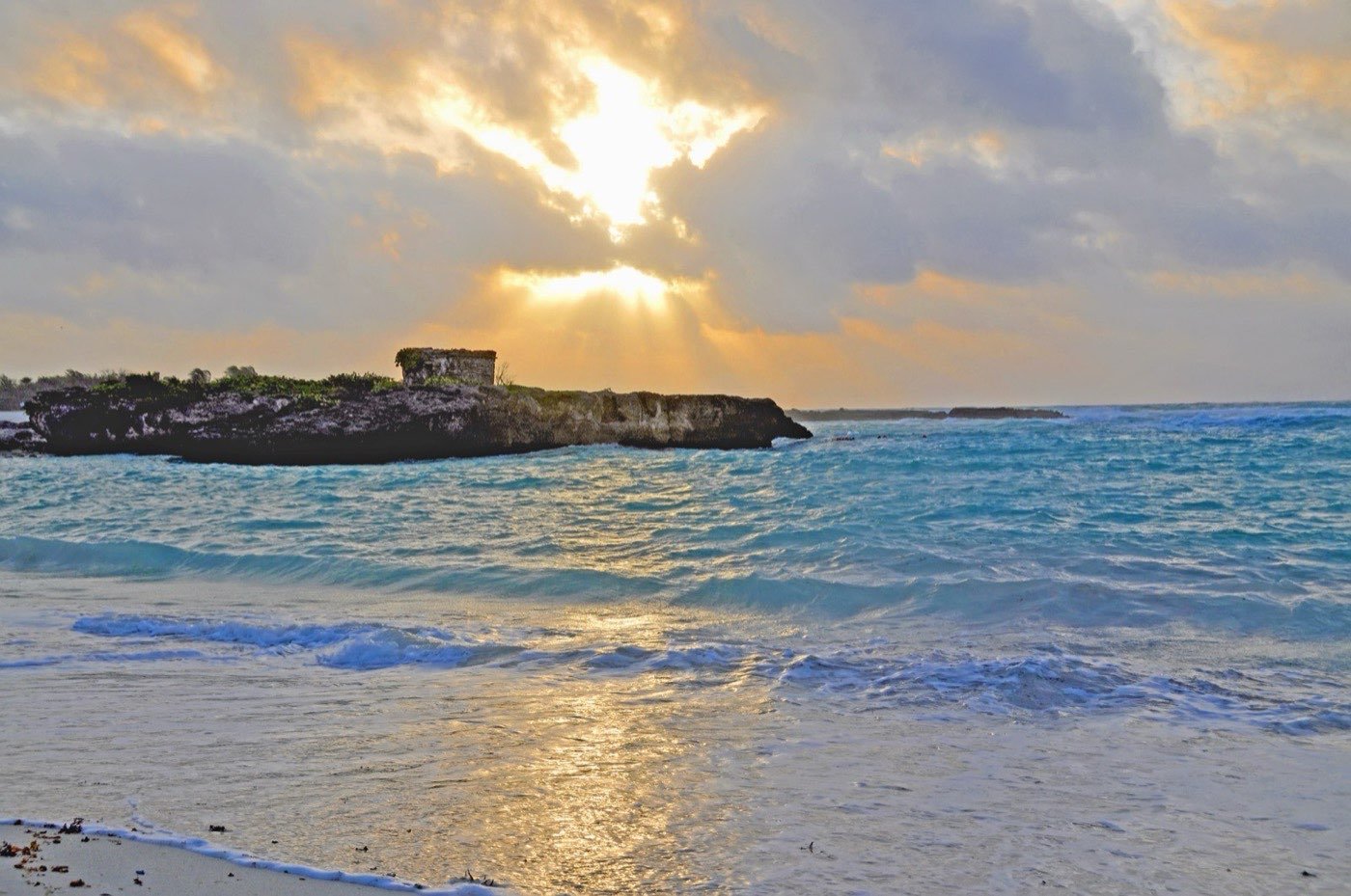
Caribbean swell geometry — only three windows ever open
To surf Cancún strategically you need to understand the geography of the Caribbean swell window. Picture the eastern coast of the Yucatán peninsula. The Hotel Zone strip faces almost due east (azimuth ~110°), guarded by the Mesoamerican Reef diving offshore. Swell can only reach the beach from directions that "see" open water and slip past or wrap around the reef. In practice there are three geometric pathways:
- ENE (045–075°) — the primary working direction. Generated by Norte cold fronts pushing down from the Gulf of Mexico (winter) and by trade winds in summer. Wave energy travels short fetch (300–600 km) so the swell is short-period (5–8 s), choppy and wind-blown.
- E (075–105°) — central trade-wind direction. Generated by sustained Caribbean trades blowing west across 1,500+ km of open water. Slightly cleaner period (6–9 s). Most common month-to-month presence.
- SE / ESE (105–150°) — the wildcard. Generated by tropical systems tracking through the Honduras/Nicaragua corridor or southern Caribbean low-pressure rotations. Period can spike to 10–14 s when a real system is involved. Rare but it produces the cleanest reform waves at Forum and the south end of Chac Mool.
Any swell coming from the N (000–045°) is partially blocked by Isla Mujeres and Holbox, and anything from the S (180°) is fully blocked by Cozumel and the Honduras land mass. That leaves the directional cone above — and within that cone, the season determines which sub-direction dominates.
November to February — ENE Norte season
This is Cancún's "winter swell" period. Cold fronts (locally called Nortes) push down from the Gulf of Mexico every 5–10 days from mid-November through late February per NOAA historical wind data. Each Norte event lasts 24–72 h and generates short-period wind-swell from the ENE.
- Typical conditions during a Norte: 25–35 kn ENE wind for 36 h, building seas to 1.5–2.5 m offshore, with reformed faces of 0.8–1.5 m at Chac Mool and Delfines.
- Off-Norte days: light E trades, faces drop to 0.4–0.8 m, surfable on a longboard but mellow.
- Days per month with surfable conditions: roughly 10–15 in November, 12–18 in December, 12–18 in January, 10–14 in February.
- Wave quality: messy. Wind is onshore by definition when the swell is generated. Glass-off windows are rare and short.
- Water temperature: 25–27°C. Boardshorts or rash guard.
This is the season our Norte-front surf guide dives deep into. If you have to pick one window to come to Cancún specifically for surf (rather than as a surf-adjacent trip), late December through early February is statistically your best shot.
March — transition month
March is a transitional month between the Norte season and the dead spring. You'll still see 3–6 Norte events early in the month, tapering off completely by the third week. Swell direction drifts from ENE toward E as the trade winds take over. Surfable days drop to 7–10 in the month — front-loaded.
If you book a March trip, plan around the first 10 days. The second half is increasingly flat.
Want a Cancún surf session matched to the right month? Book Cancún surf →
April to June — E trade-wind dribble
The trade wind season. Caribbean trades blow steady E to ENE at 12–18 kn most days, generating low-energy wind-swell with faces of 0.3–0.7 m. The water is glassy clear, perfect for diving, snorkel and kite — terrible for surf.
- April: 5–8 surfable days, mostly < 0.8 m. Foam-board only.
- May: 4–7 surfable days. Trade winds peak. Kite season starts.
- June: 3–6 surfable days. Beginning of hurricane season but no early-season storms historically have produced surf for Cancún.
If you come in this window, treat surf as bonus, not primary. Cancún diving, snorkel and kitesurf are at their peak in these months — see our guides on Cancún's water-activity menu.
July — the dead month
July is statistically the lowest-swell month of the year in the Mexican Caribbean. Trade winds soften, no Nortes, hurricane season hasn't ramped up. Average sea state offshore is 0.5–1.0 m at long period; the reef absorbs nearly all of it before reaching the beach.
- Surfable days in July: 1–3, all < 0.7 m and mostly foam-only.
- Water: glassy clear, 28–29°C, beautiful for non-surf activities.
- Recommendation: do not book a Cancún surf trip in July. If you must, treat it as a one-day rental shot in case a freak SE swell arrives.
August to October — hurricane swell windows
The most volatile, highest-stakes window of the year. Atlantic hurricane season peaks here, and tropical systems tracking through the Caribbean can produce the largest, cleanest, most photogenic surf days Cancún ever sees — or completely shut down a trip with evacuations and beach closures.
- How hurricane swell reaches Cancún: a tropical system passes north of Honduras or south of Cuba, putting Cancún on the "right-front" quadrant of the storm. This sends long-period (10–14 s) SE-to-E swell wrapping into the Hotel Zone.
- Surfline / Windy fingerprint: swell direction 080–130°, period ≥ 10 s, height building 1.5 → 2.5 m over 24 h. This is when Delfines fires head-high+.
- Surfable days per month: 4–8 in August, 6–10 in September (peak), 4–8 in October. Highly bimodal — either flat for days or pumping for 48 h then gone.
- Hazards: rip currents triple, red-flag beach closures, sargassum slop, electrical storms. Lifeguards close beaches once seas hit certain thresholds.
- Monitor: NHC 5-day forecast cone, Magicseaweed swell models, local CONAGUA advisories.
See our dedicated hurricane swell windows guide for how to read the cone of a tropical storm and decide whether to fly toward or away.
Month-by-month probability table
| Month | Dominant direction | Surfable days (avg) | Typical face | Best break | Recommendation |
|---|---|---|---|---|---|
| January | ENE | 12–18 | 0.8–1.5 m | Delfines / Chac Mool | Strong window — book it |
| February | ENE | 10–14 | 0.8–1.4 m | Delfines / Chac Mool | Strong window |
| March | ENE → E | 7–10 | 0.6–1.2 m | Chac Mool | Early month only |
| April | E | 5–8 | 0.4–0.8 m | Chac Mool | Surf-adjacent only |
| May | E | 4–7 | 0.3–0.7 m | Chac Mool | Pivot to other activities |
| June | E | 3–6 | 0.3–0.7 m | Chac Mool | Pivot |
| July | E (light) | 1–3 | 0.3–0.6 m | — | Dead — do not book |
| August | E / SE (hurricane) | 4–8 | 0.5–2.0 m | Delfines | Volatile — track NHC |
| September | SE / E (hurricane peak) | 6–10 | 0.6–2.5 m | Delfines / Forum | Highest stakes |
| October | E / ENE | 4–8 | 0.5–1.5 m | Delfines | Hurricane tail |
| November | ENE | 10–15 | 0.7–1.5 m | Delfines / Chac Mool | Norte season starts |
| December | ENE | 12–18 | 0.8–1.5 m | Delfines / Chac Mool | Peak Norte month |
How to interpret a Caribbean swell forecast — direction first
Most surfers, especially those used to Pacific groundswell, look at swell height first. In Cancún that's the wrong instinct. The order of importance is:
- Direction (most important): if it's not ENE, E or SE, the wave is being blocked by something. Even a 3 m N swell won't reach the beach because Isla Mujeres breaks it.
- Period (second): short-period 4–6 s = wind-chop, big mush. Long-period 9+ s = clean reform, fast take-off. Hurricane swell at 11 s feels like a different ocean than wind-swell at 5 s.
- Height (third): 1.2 m short-period offshore = 0.6 m reform onshore. 1.2 m long-period offshore = 0.9 m reform with push.
- Wind direction (critical): even if the swell is good, an onshore SE 25 kn wind will trash the wave. Light wind from any direction or offshore W is gold.
The Federación Mexicana de Surfing publishes condition advisories during competition events that double as useful real-world calibration for what "good" looks like at Cancún breaks.
Cancún surf calendar at a glance — when to come, when to skip
- Best month for a dedicated surf trip: December or January. Most consistent Nortes, water still warm, no hurricane risk.
- Best month for the biggest waves (high-risk, high-reward): September. Hurricane swell peak. Bring intermediate skills minimum.
- Best month for a surf-adjacent trip: November or March. Mix of small surf and good conditions for diving, snorkel, kite.
- Worst month for surf: July, then June, then May. Trade-wind dribble, no Norte, no hurricane yet.
- Most unpredictable month: September. Could be the surf trip of your life or 10 days of evacuation. Hedge with travel insurance and flexible booking.
Cross-reference your dates with the honest state of Cancún surf and our break-by-break detail guide so you arrive with realistic expectations and a Plan B already booked.
Book your Cancún surf with the season in mind. Book Cancún surf →
Frequently asked questions
What is the best month to surf in Cancún?
December and January, statistically. Norte cold fronts hit every 5–8 days, generating ENE wind-swell that reforms into rideable 1–1.5 m faces at Delfines and Chac Mool. Water is still 25–26°C.
Can I surf Cancún in summer (Jun–Aug)?
Only marginally. June–July are the deadest months. August is the start of hurricane season — possibly the best surf of the year if a storm tracks favourably, otherwise flat. Don't book a dedicated surf trip in summer.
What swell direction is best for Cancún?
ENE (045–075°) is the primary working direction. It feeds both Chac Mool and Delfines during Norte season. SE swell from hurricanes is rarer but produces the cleanest, longest-period waves of the year.
Are there really hurricane-swell surf days?
Yes — 6–10 days per year in September, fewer in August and October. These produce the biggest waves Cancún ever sees, but require an active storm offshore. Track via NHC and accept that beach closures may pre-empt the session.
How do I check the swell forecast for Cancún?
Three tabs: Surfline (primary surf forecast), Windy (wind and swell models, ECMWF is reliable), and the NHC during Aug–Oct. Cross-check 48 h out. Direction matters more than height.
Pick the right month for your trip
Send us your dates and we will tell you honestly whether surf is likely, plus a Plan B for flat days.